Make Better Location Decisions.
Explore police-recorded crime data around any postcode, school, or property — and compare the neighbourhood with the wider local authority.
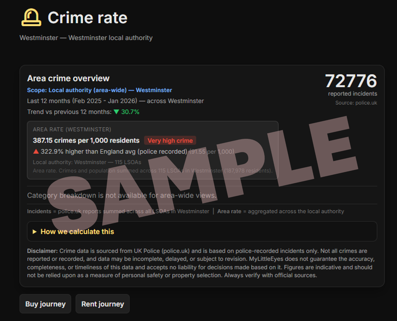
Understand the Bigger Picture.
- See police-recorded incidents within ~1 mile of a location
- Compare the neighbourhood rate with the local authority average
- Track trends over the last 12 months
- Data sourced from police.uk (police recorded)
i spy with
 something beginning with ... " C "
shield
....... Crime Rate